A short night's sleep after I'd arrived in Whitehorse, I was already at the gate again, ready to head up north, following the call of the gold to Dawson City!
GPS-Track: [url]http://de.wikiloc.com/wikiloc/view.do?id=2537536[/url]
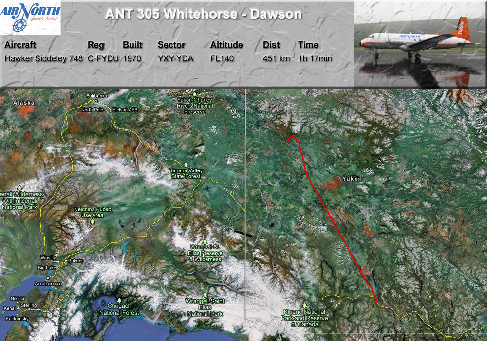
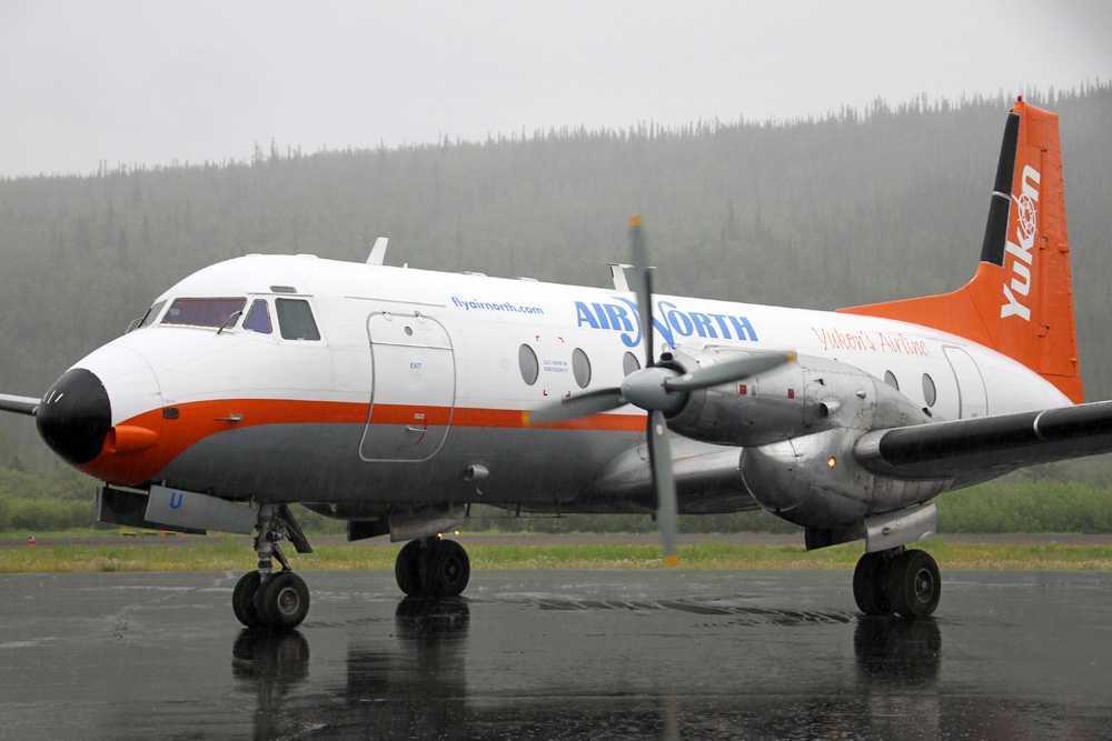
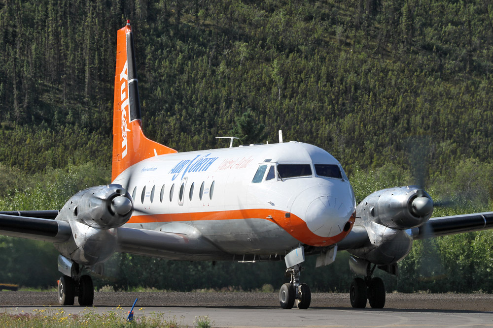
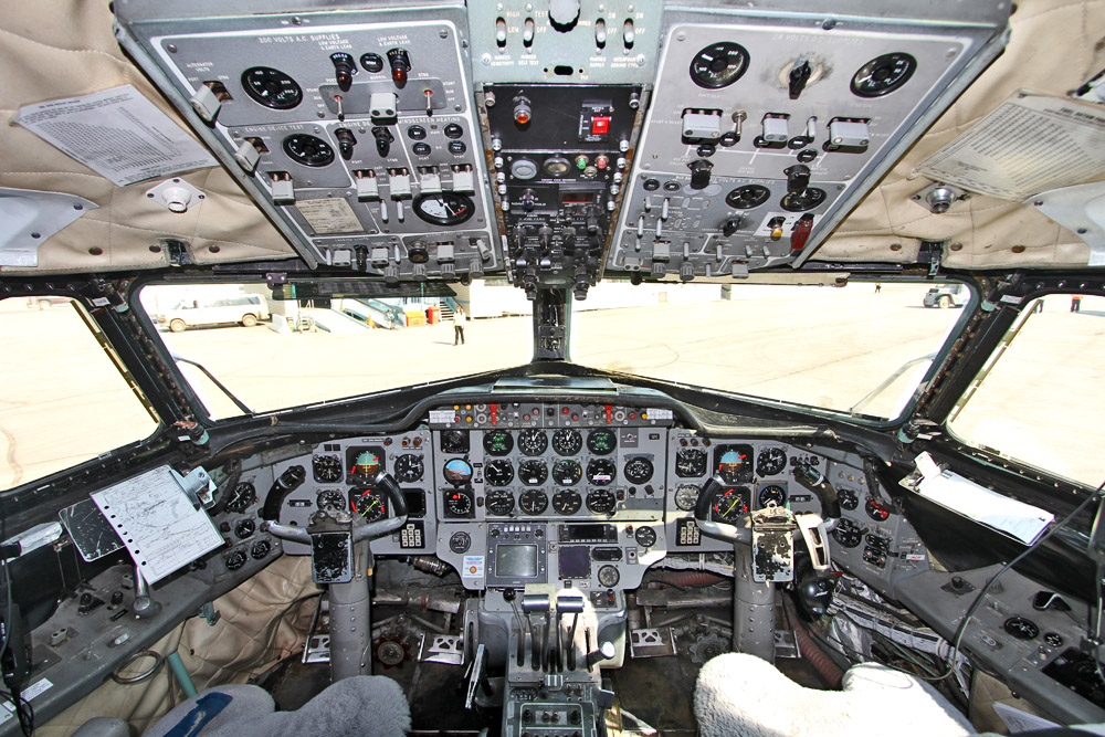
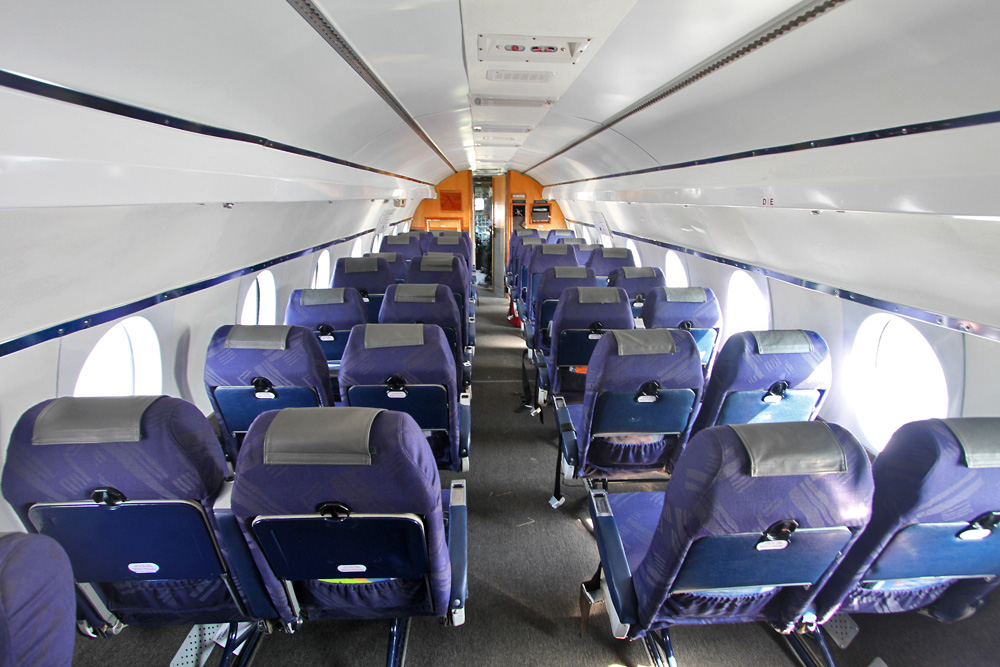
The British HS-748 is a medium-range turboprop airliner, designed in the late 1950s as a replacement of the DC-3. Thanks to its good STOL capabilities, the aircraft seating up to 58 passengers was a considerable success in its niche and is still used today on thin routes requiring good performance.
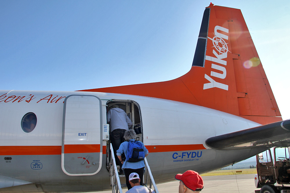
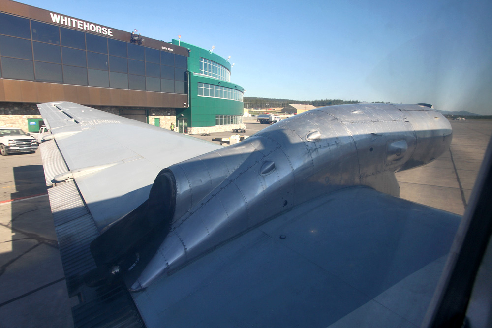
We're all set, and leaving Whitehorse's terminal
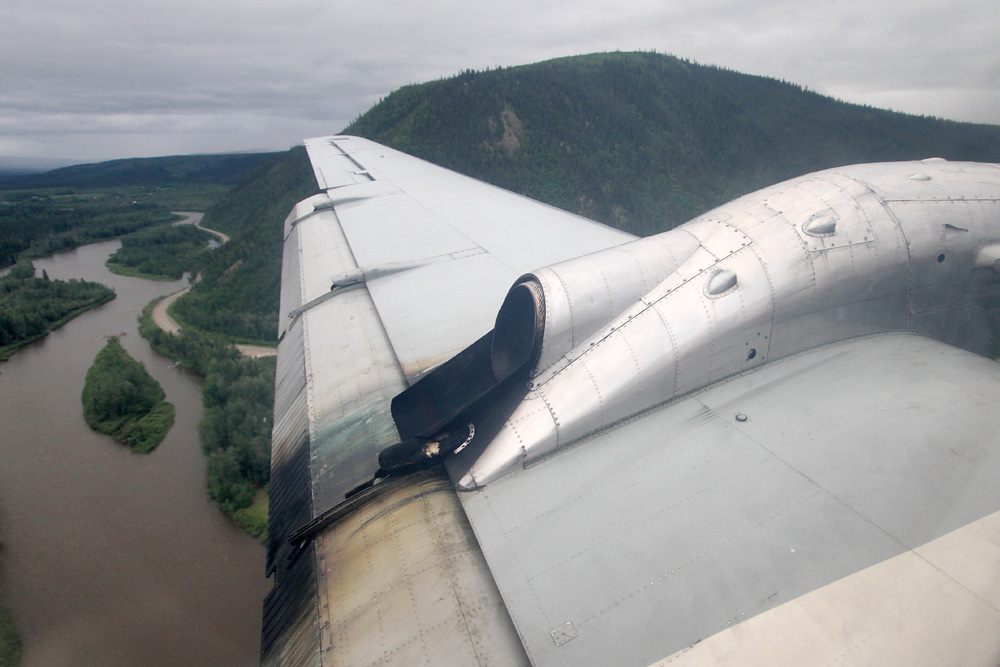
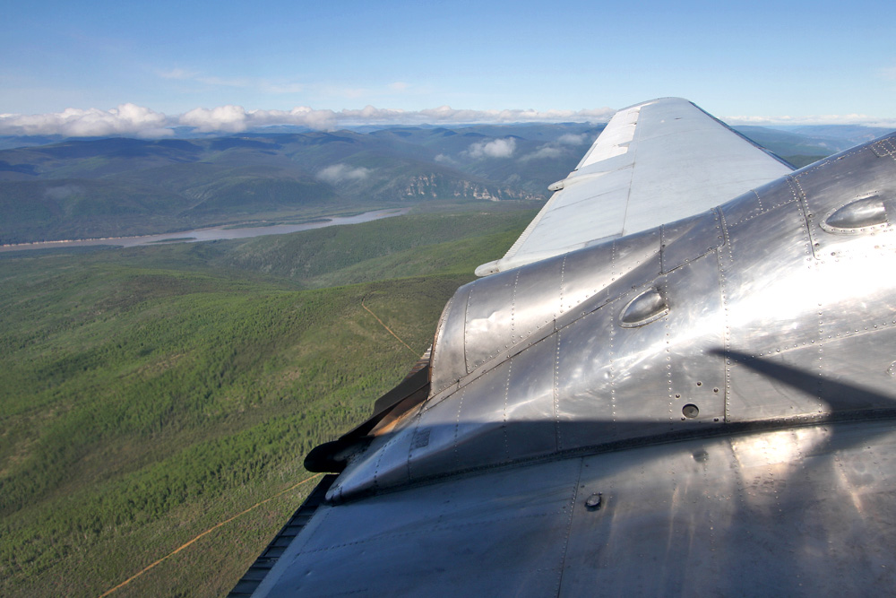
The climb was nice and slow, and offered some great close-up views of the Flat Mountains north of Whitehorse - here's a short vid, including a brief look around the cabin, too.

The approach to Dawson is pretty challenging, and requires following a GPS track through the narrow valley of the Yukon river to the runway. Unfortunately, the weather was miserable and there wasn't much to see.
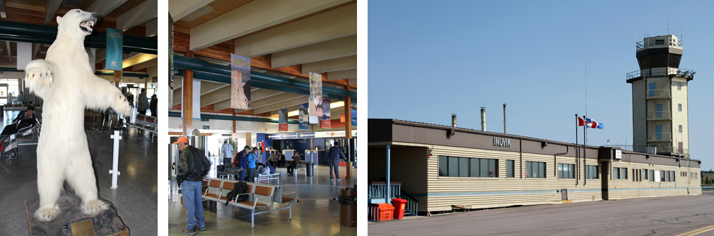
Welcome to Dawson City Airport!
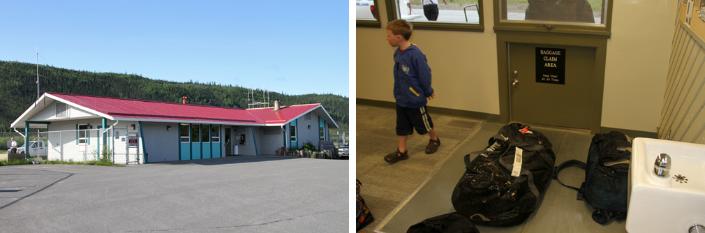
Just after our arrival, a heavy downpour started!
While I got to stay in Dawson for a night, the old lady already stormed over the gravel runway again and took off to her next destination.
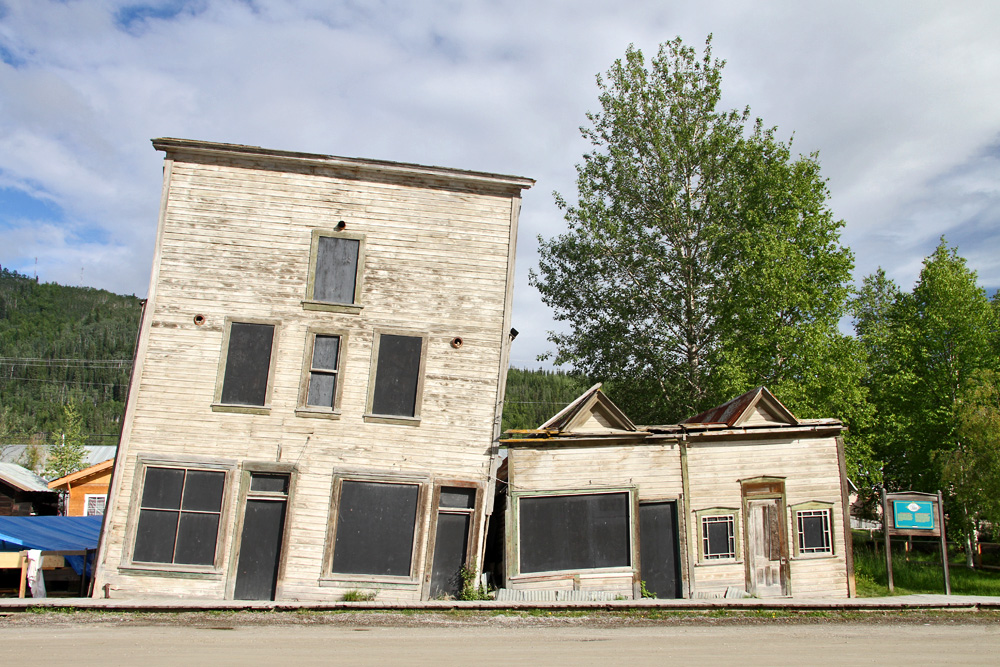
Today, Dawson is a serene and picturesque little town showing off its gold rush past

This was totally different while the rush was on, of course, when ten thousands of gold diggers came steaming up the Yukon from Whitehorse. Less than five percent of them ever found any gold, by the way!

Of course, there was no time to build high quality housing back then - and so, one can admire some interesting relics nowadays!
Quite fitting!
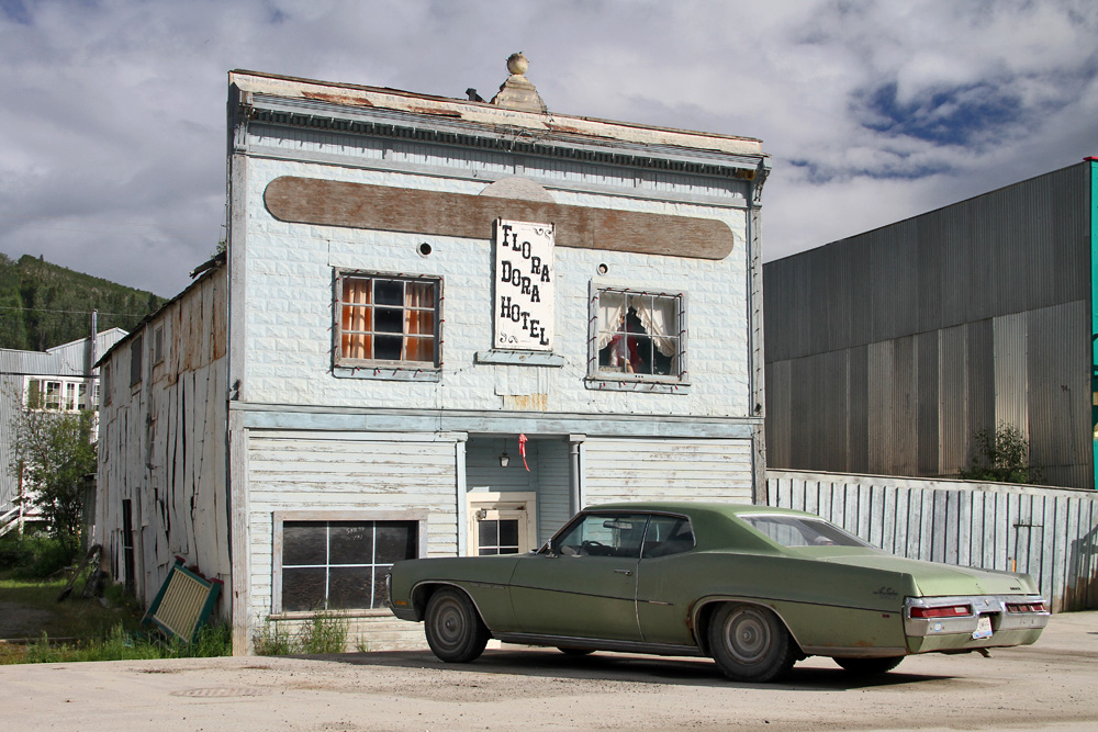
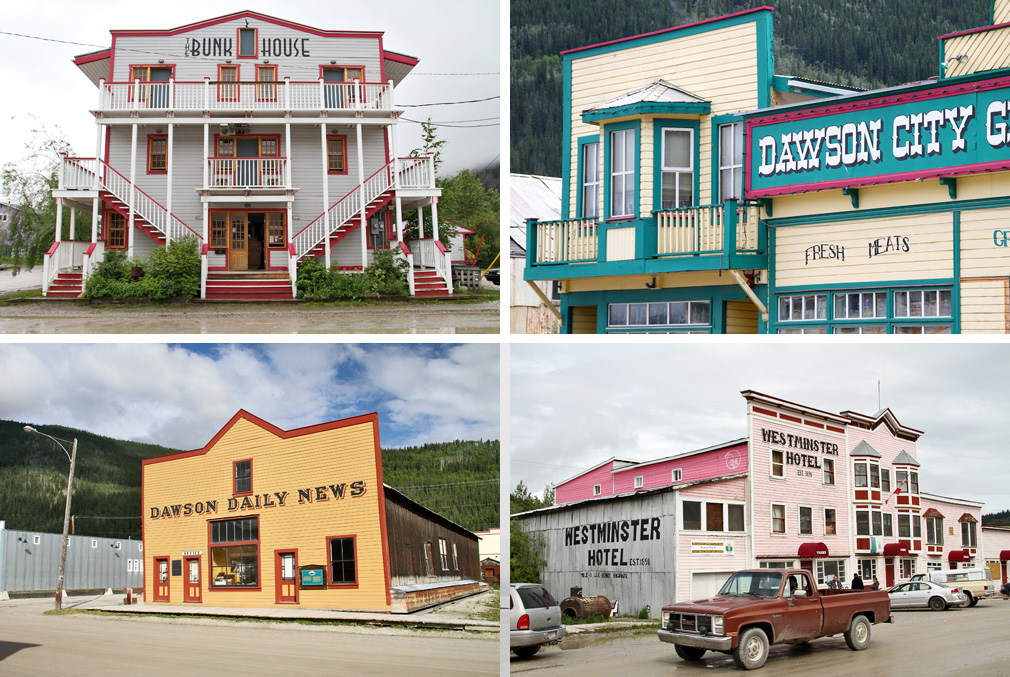
Besides those few dumps, there are dozens of nicely restored buildings though, which make Dawson a really nice and interesting place to visit!
I enjoyed the almost endless daylight up here, and went out for walks around town at 11PM and 2AM in the night - lots of fun!
After another short night I was back at the little airfield, which was slowly coming to life. A few hung-over bush pilots were strolling to their planes, and a first Super Cub was taking to the skies. Finally, with a delay of 30 minutes, my plane showed up overhead, and landed after an adventurous visual circling: Et voilà, 41-year old HS748 C-FAGI still going strong!
GPS-Track: [url]http://de.wikiloc.com/wikiloc/view.do?id=2583691[/url]

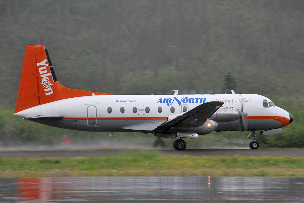
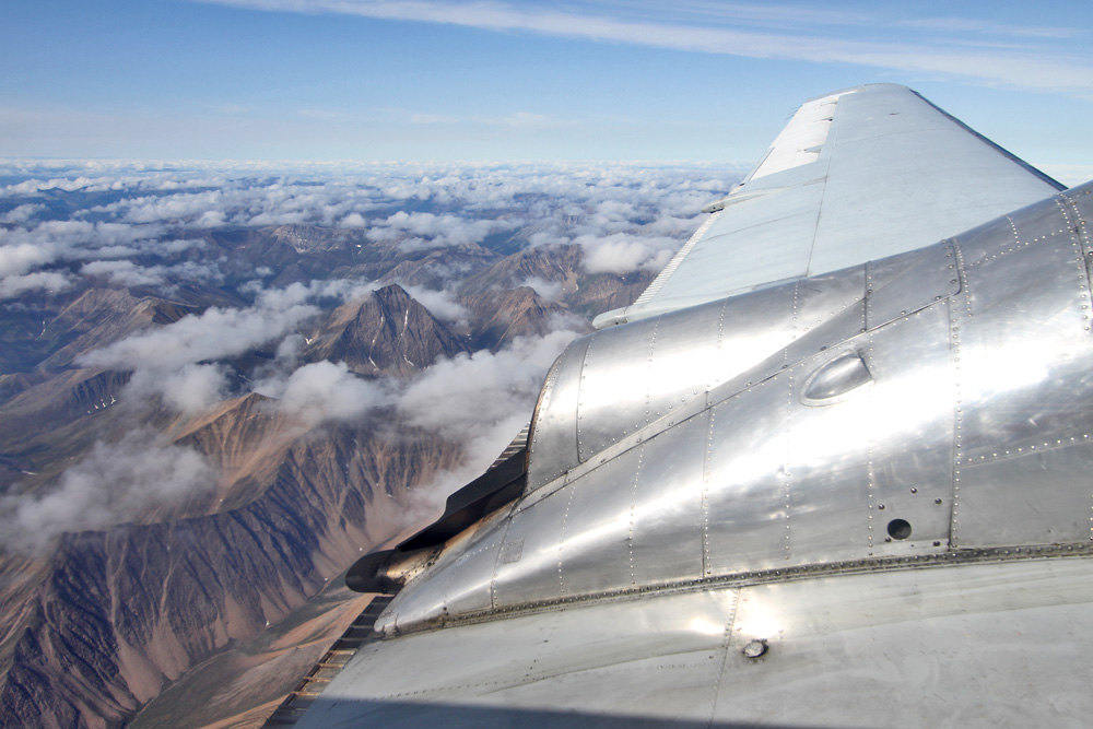
After a 15 minute stop, we were ready to go, taxied to the runway, and backtracked a little bit. On the mere 1,5km gravel strip every horsepower counts, and so, soon after, 4600 of them were let loose and pushed the 20 tons of steel into the morning air. A few turns to follow the Yukon valley first, and then we set course for our next destination, Old Crow.
Behind those hills would be Alaska, by the way.
The next landmark we cross are the Ogilvie Mountains...
...und soon our intermediate stop, the settlement of Old Crow, comes into view. It is home to a population of 267, largely made up of Gwitch'in native people, and with no roads going there, can only reached by water and air.

Turning finals over the mighty Yukon - yeah!

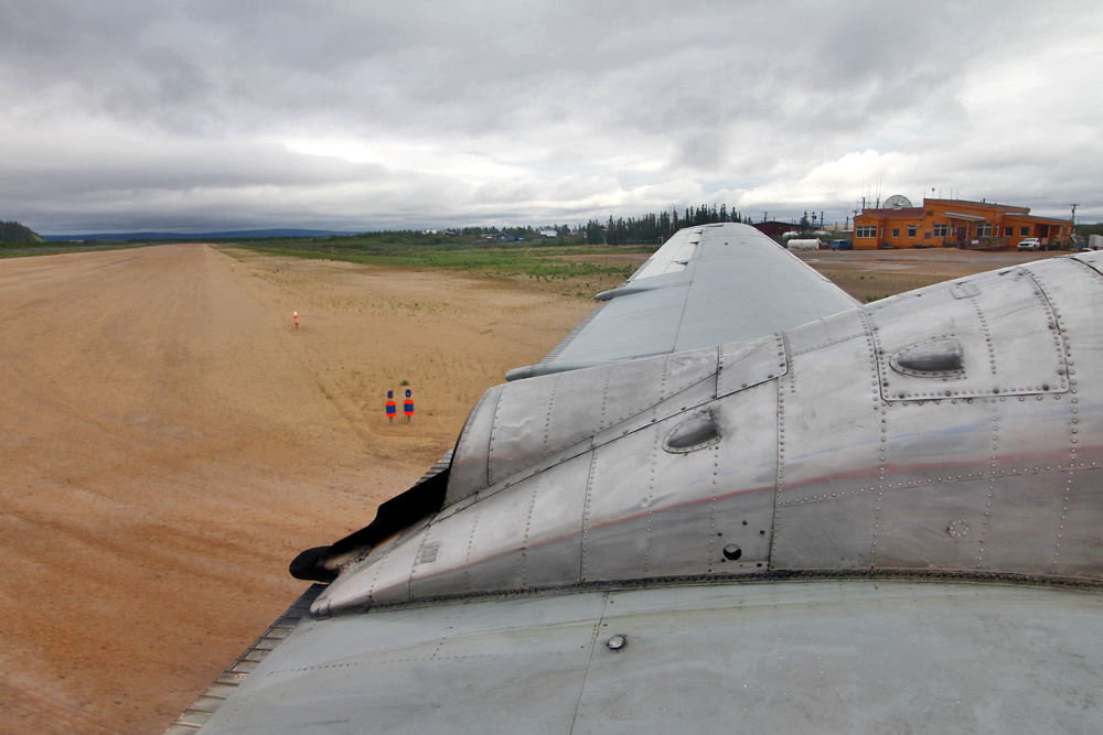
We land smoothly on the bumpy gravel runway, and only seconds after touchdown, the plane already comes to a complete stop in front of the cute little wooden terminal. Half a dozen passengers get off, and about twice as many get back on board - together with the inflight entertainment: A fleet of 100 mosquitos, which would keep our hands extremely busy for the remainder of the flight!
After a record-breaking five minute turn-around and an extremely brief taxiing we took off again, heading for Inuvik, the administrative city of the north. Meanwhile, the eskimo woman in the seat next to me answered all my questions about their daily life. How most of them still lived on a Reindeer diet, and used all non-edible body parts of the animal to craft tools or clothing. But also how things have changed: How the rifle replaced bow and arrow, how the huskies were superseded by ski-doos, and how Reindeer herds weren't tracked down reading their footprints anymore, but looking at their GPS logs on the internet.
This led to dramatic changes. The number of Reindeer is in a rapid decline, while problems with drugs and alcohol are on the rise. Most youngsters experience a total identity crisis, torn between MTV, Social Media and Lady Gaga on one side, and living a simple life according to century old traditions in one of the most remote areas of the world on the other. Suicide rates are skyrocketing, and Old Crow even had to implement alcohol prohibition again.
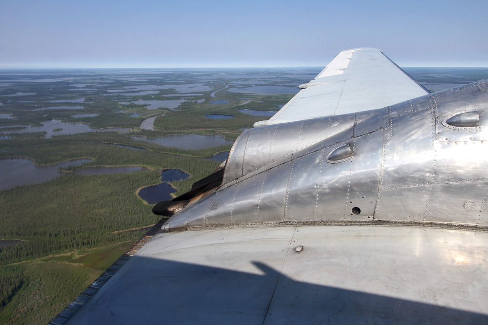
All these stories (and swatting all those mosquitos) let the one-hour flight pass by in minutes, and before I knew it, we were approaching Inuvik flying over a myriad of small lakes. The plane touched down on the long, paved runway and dropped me off up here, before returning on the same way back to Whitehorse. I stayed in Inuvik for the night - or for the never ending day, to be precise.
Before heading into town, I had to take a look at cockpit and cabin of this northern puddle jumper though!
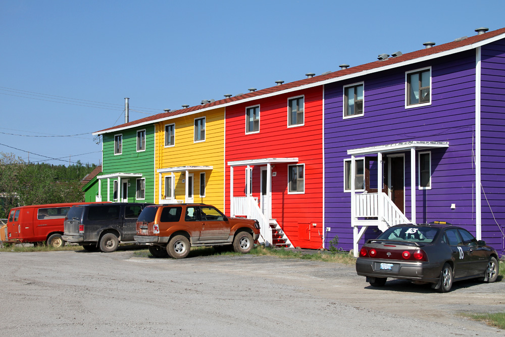
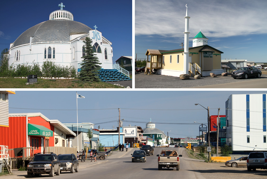
Inuvik's main purpose is the administration of all the small, outlying eskimo communites as kind of a capital of the extreme north, and there's not too mucht to see. At least the houses are colourful!
There are two points of interest though: The traditional Igloo Church, and Inuvik's famous new attraction: The tiny Midnight Sun Mosque, the pride of the small muslim community up here. Admittedly, the petite building doesn't have the typical grandeur of mosques in other countries, and the roughly cut out half moon on top of the minaret doesn't help, either. The story how it got here in the first place is pretty impressive though: Since the small community here would never be able to afford such a building, a religious society from the south sponsored the mosque. After having been built down in Winnipeg, the tiny mosque embarked on a 4'000km long odyssey, riding on semi-trucks and cargo ships. More than once, the building was almost lost on the way, tumbling down the road or sinking in the mighty Mackenzie River. And so, after all those troubles, every inhabitant of Inuvik, muslim or not, longed for the day when the mosque would finally come riding around the last river bend. What a nice story!
Finally I was ready to return to my hotel - only that I couldn't sleep, because I just had to witness the midnight sun. Which of course kept shining way past midnight, in a kind of beautiful eternal sunset too good to miss. Thankfully, the orange disc briefly sank below a few tree-tops at half past four, which allowed me to catch some sleep at least.

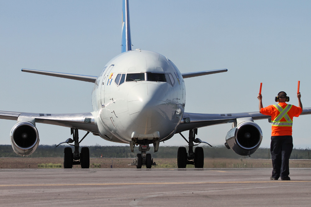
Back to the airport the next morning - but it didn't take long and a great sound made me wide awake! Here's my ride down to Yellowknife!
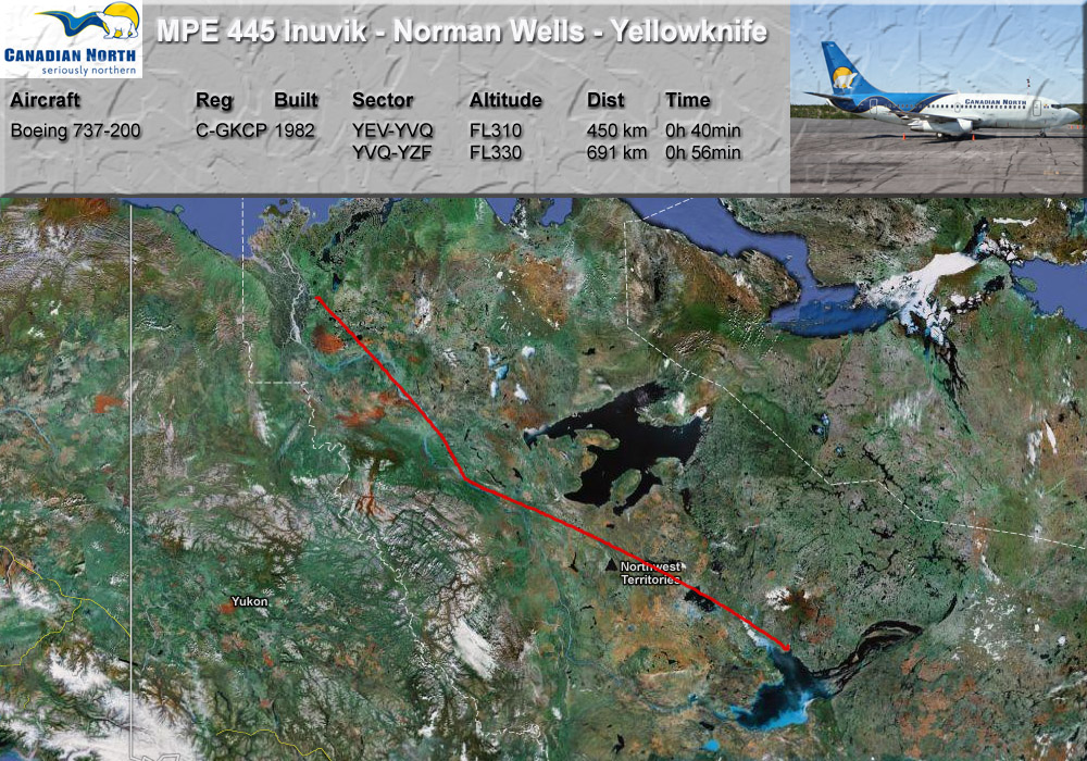
There are not too many directions left to go from here, and so it's finally south again, heading for Norman Wells and Yellowknife.
GPS-Track: [url]http://de.wikiloc.com/wikiloc/view.do?id=2537539[/url]
But it took some time to get on the way! First, people had to be re-seated, as the five rows in the back were used to transport prisoners. And when were already taxiing toward the runway, sirens were going off and cars were rushing over the apron. A breakout? Nope. One of the bush pilots touched down a little too hard, and was now stranded on the runway with a flat tire!
Finally, after 20 minutes, the small plane could be moved from Inuvik's single runway, in order to make space for the big guys: us!
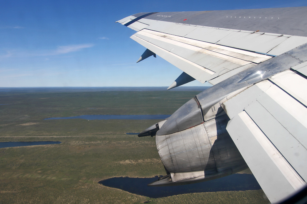
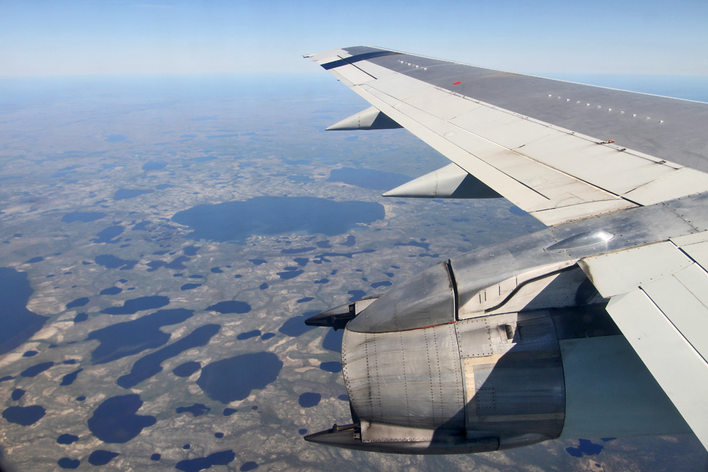
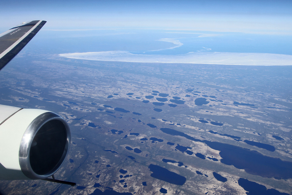
Just the shot I'd planned for: The old engine over the unique scenery of the north!
Of course there needed to be an intermediate stop on this route, too. And so, shortly after reaching our cruising altitude of 31'000, the pilots started descending down to the airport of Norman Wells, where we landed after a straight in approach. The small town's runway measures a mere 6'000ft/1,8km (that's only 300 meters more than London City!), which meant: Full Reverser Action! Yaay! What a sight to see, and what a sound right in front of my window!
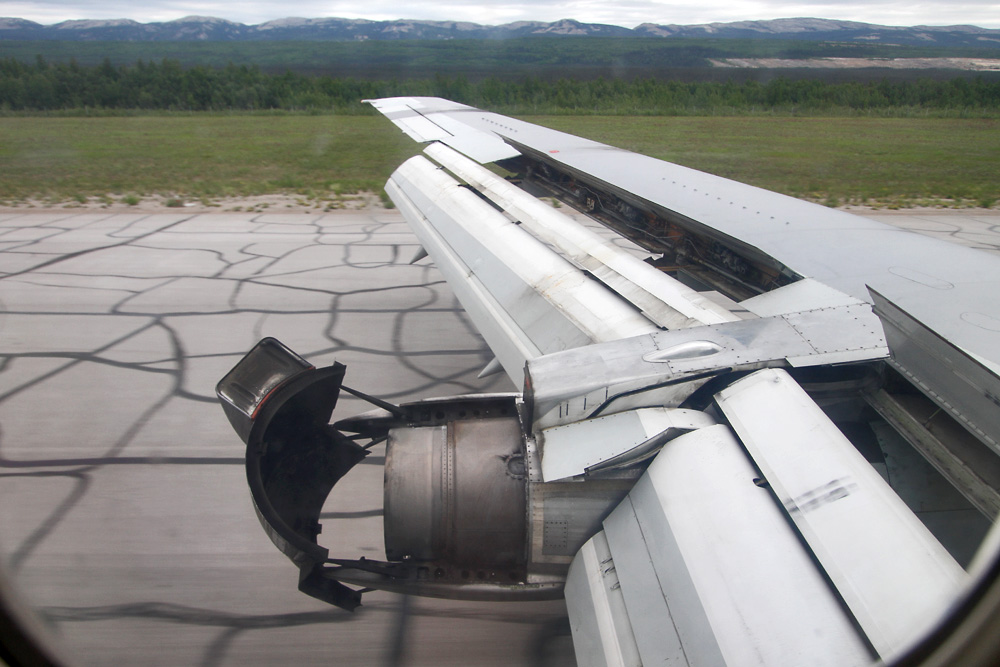
Here's the 30-year old beauty on the tarmac of Norman Wells. The town which accomodates 800 inhabitants is dominated by the oil business - as the local people had already known when they gave it the name of "Tłegǫ́hłı̨": "Where there is oil"

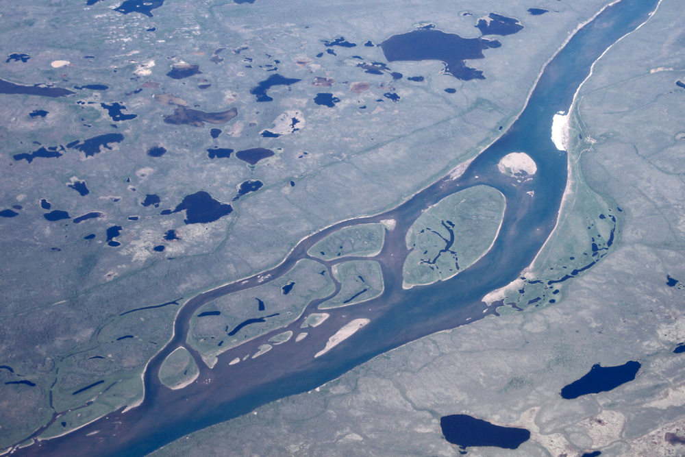
During the one-hour ride to Yellowknife, nature once more dished out all the beauty of the north. First the mighty Mackenzie River, after which the valley is named...
...some nice meandering rivers...
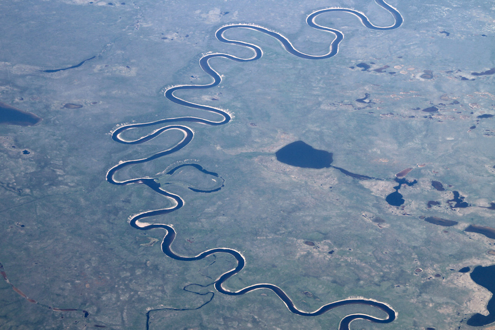
...and finally hundreds of little ponds, with the still partly frozen (in late June!) Great Bear Lake in the background.
Yellowknife city is coming up on the right, and its airport can be seen a little left of the center. To finish the day off, the pilots performed a nice, tight visual approach - well done!

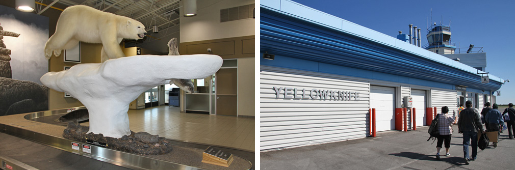
Welcome to Yellowknife!