Looking at this whole itinerary easily explains why I had to get up at 4 AM!
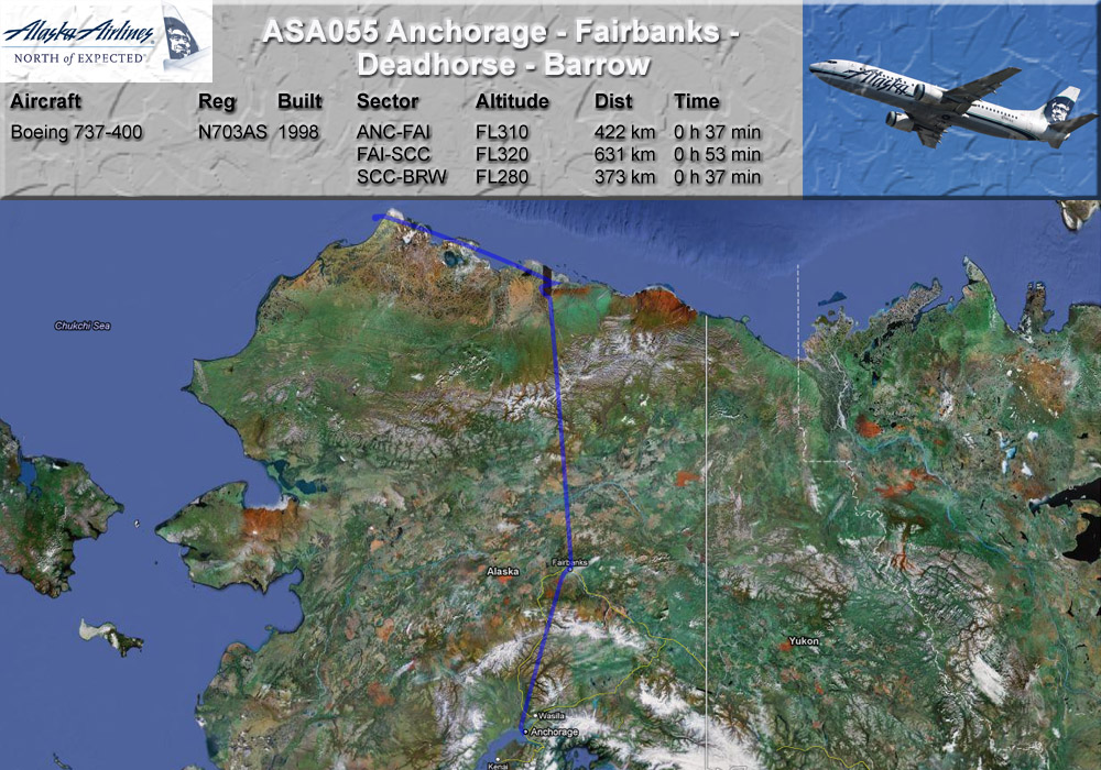
GPS-Track: [url]http://de.wikiloc.com/wikiloc/view.do?id=2505990[/url]
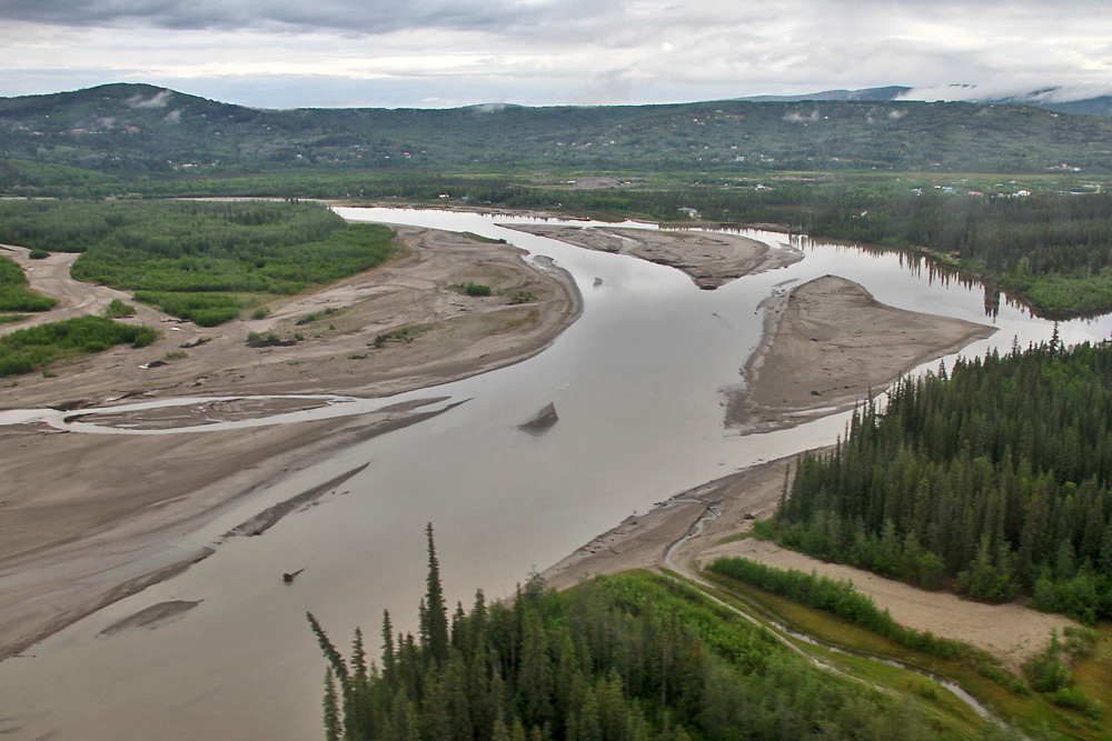
The first leg from Anchorage to Fairbanks wasn't overly interesting. While the US' highest mountain, Denali, would be an easy sight to spot along the route, it was unfortunately covered in clouds today. Therefore we jump right into the approach to Fairbanks, well the Tanana River welcomed me to the interior.
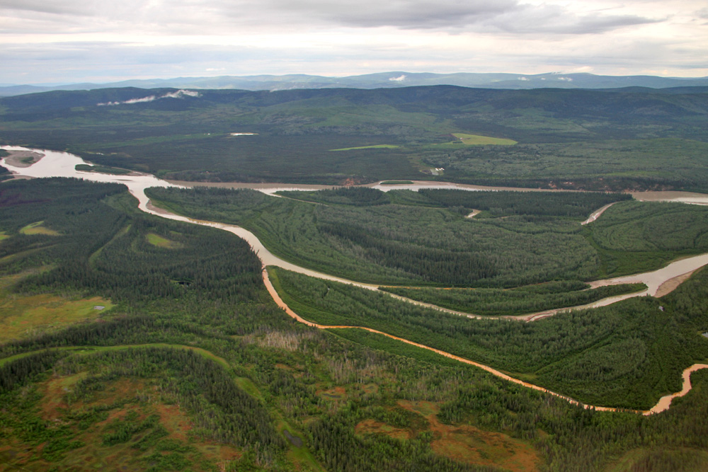
Shortly before touchdown we finally cross the river
Flight Attendant's remark after landing: "Welcome to Fairbanks, my hometown, and the most beautiful city in the world!"
Most passengers had only used our flight as a shuttle between Alaska's two biggest cities and were getting off here - but for me, the fun was just about to begin! After half an hour, we were pushed back again from our gate and made our way to the runway for the second leg of the day: Up to Deadhorse.
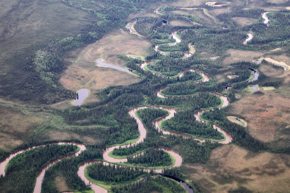
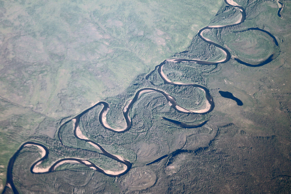
One of many beautiful rivers along the way, the Hodzana
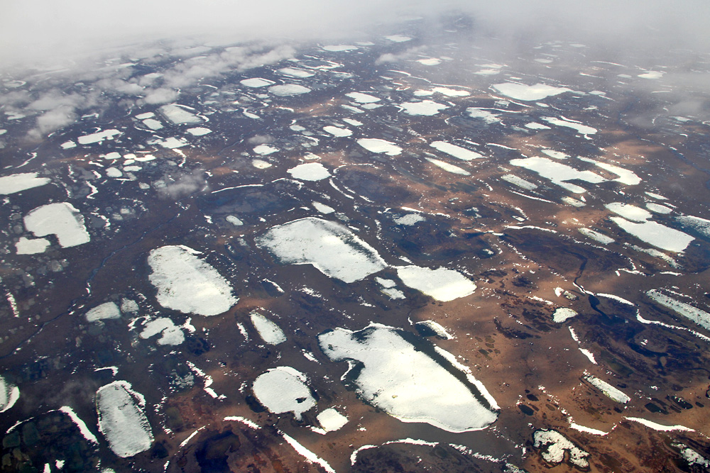
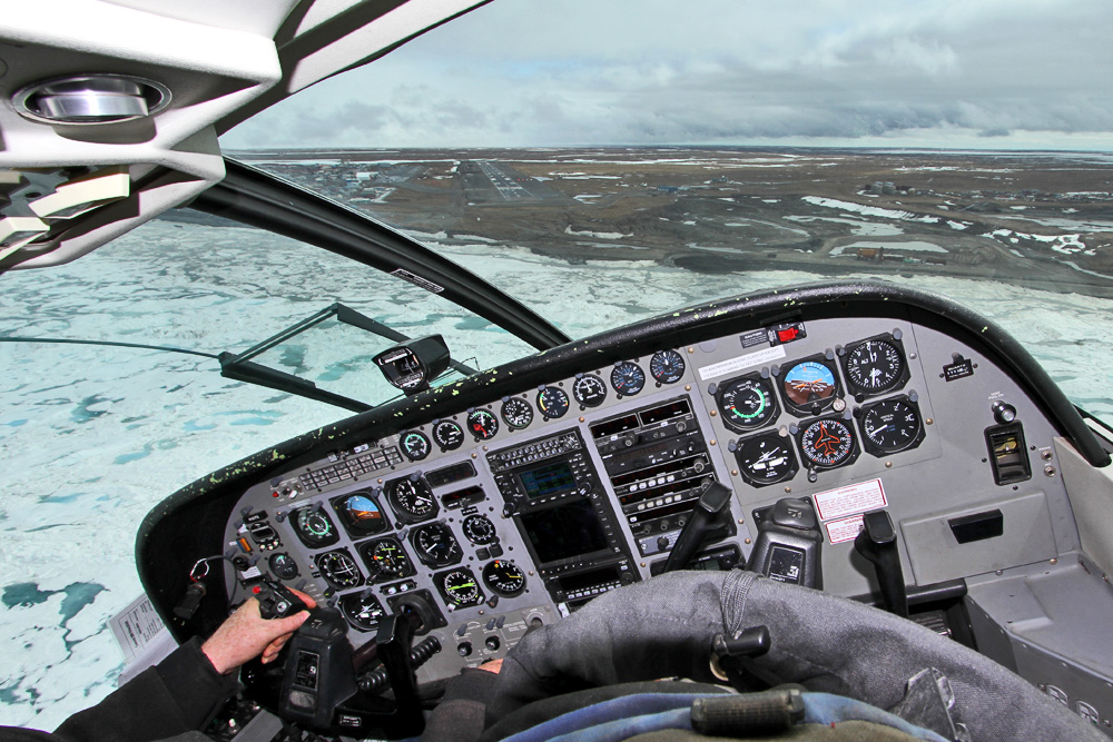
Twenty minutes later, the scenery outside has changed completely. Welcome to the North Slope Region north of the Polar Circle!
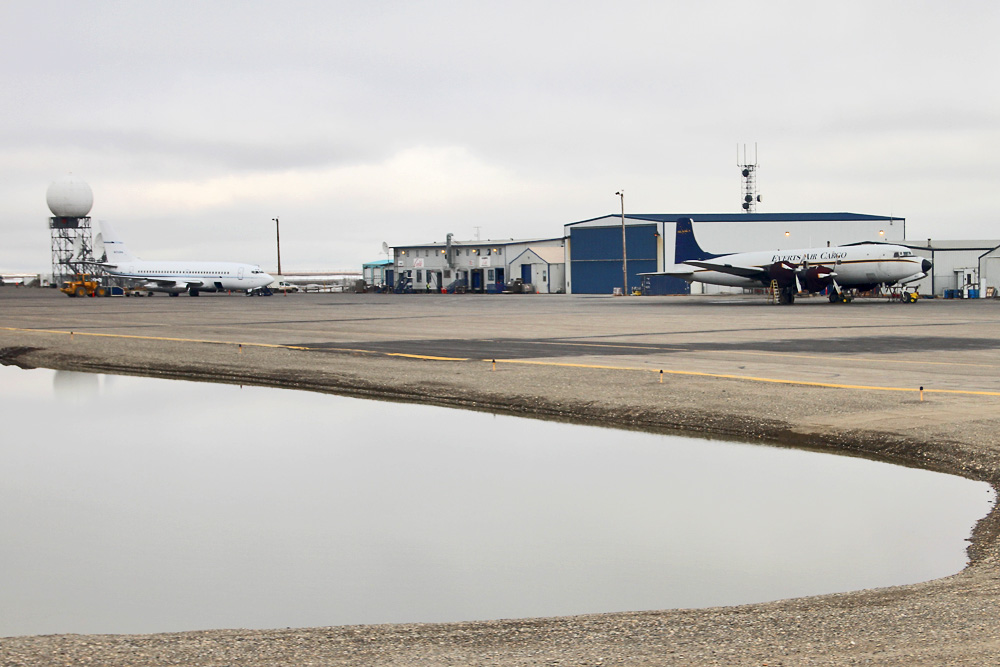
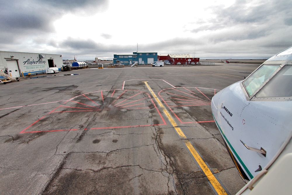
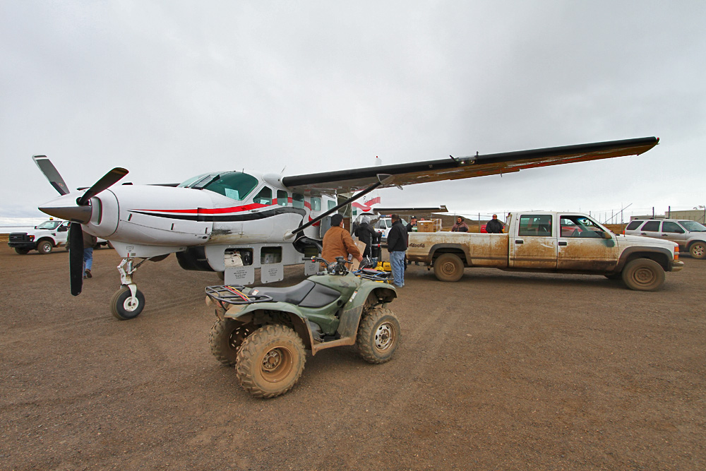
The above picture was made shortly before touching down at Deadhorse's airport. On the apron, a 737-200 of an oil company and a DC-6 of Everts Air Cargo welcomed us. The reason for all that traffic is nearby Prudhoe Bay, where the biggest oil field of the United States lies. This causes dozens of flights to bring in supplies, machinery and parts.
But not only gear is transported to the far north, also the transient workforce of over 3'000 people has to be flown in and out. While most of them are carried on the oil companies' planes like the 737-200, there were a few of them getting off our scheduled flight, too, and the very attentive flight attendant wished everyone of them a good week. A few minutes later, dozens of workers boarded, and the flight attendant switched to "had a good week, honey? Feels good to be heading home, huh?".
The crew instantly started going out of their way to pamper the tired workers ("want a beer after your hard week, honey?"), who obviously appreciated the caring service. When I congratulated the flight attendant on their great service and told her that I'd never experienced something like that before, she was quite surprised and replied: "This is Alaska, these are my people. I'm honored to serve them."
Now that's something new in the year 2012! Kind service, not because your contract says so or because a bonus awaits you, but because you're actually caring about your customers. Oh how I love the Alaska spirit!
After little more than half an hour we're ready to head on to our final destination: Barrow, the northernmost city of the USA. And the short flight there offered yet another chance to admire the charms of the north.
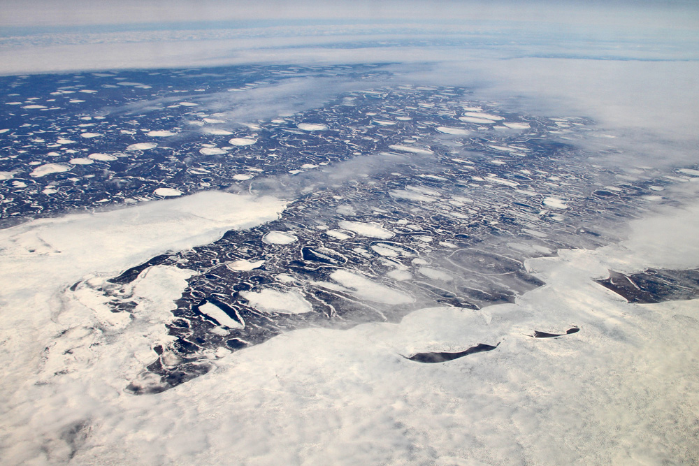
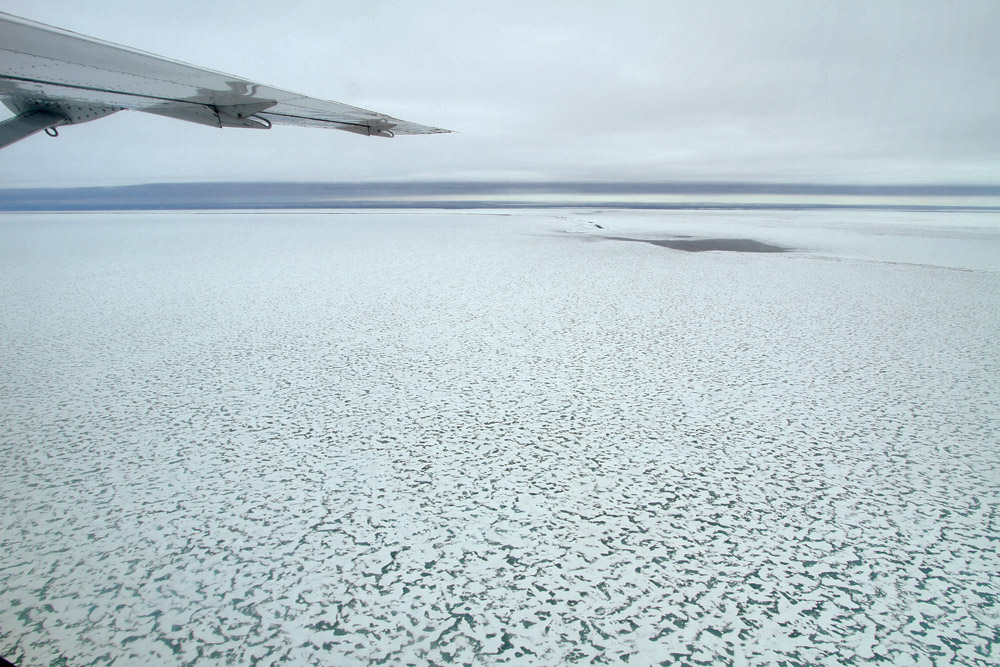
Beware: What we are overflying here isn't just a sea of clouds, but actually the frozen Arctic Ocean! Beautiful!
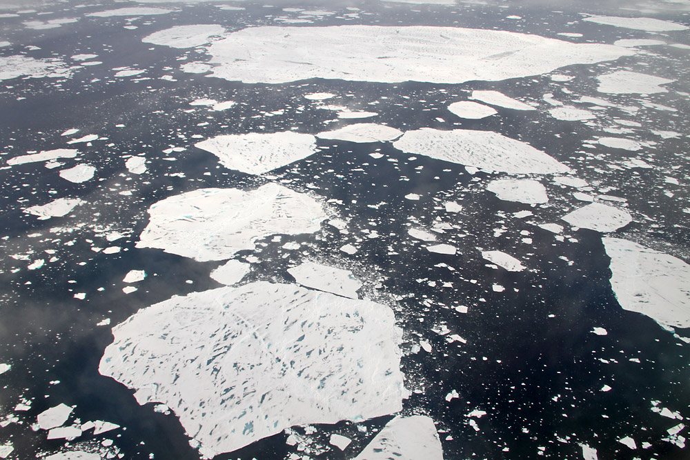
We pass the same again half an hour later, while our pilots are getting out 737 established on the runway heading at Barrow. As you can see, the "break up" has already happened here - the ice cover has split into thousands of individual sheets.
Welcome to Barrow! We landed in the middle of a snow storm (in mid-June!), and even apart from that the village seemed only mildly appealing.
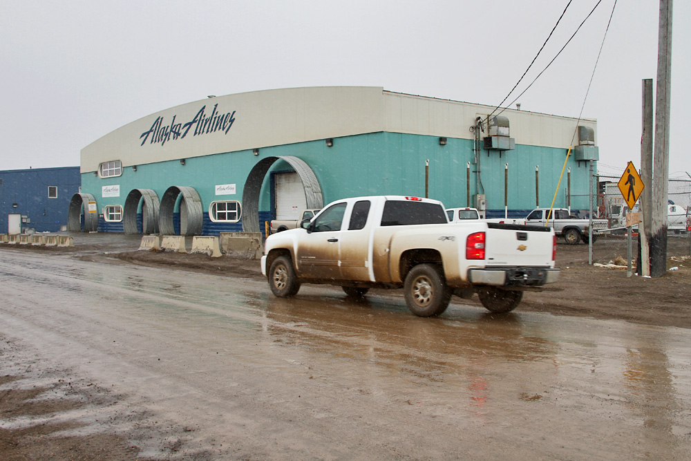
From the main terminal (pictured above), I headed straight to the bush flight "terminal" - or whatever you'd want to call that shack!
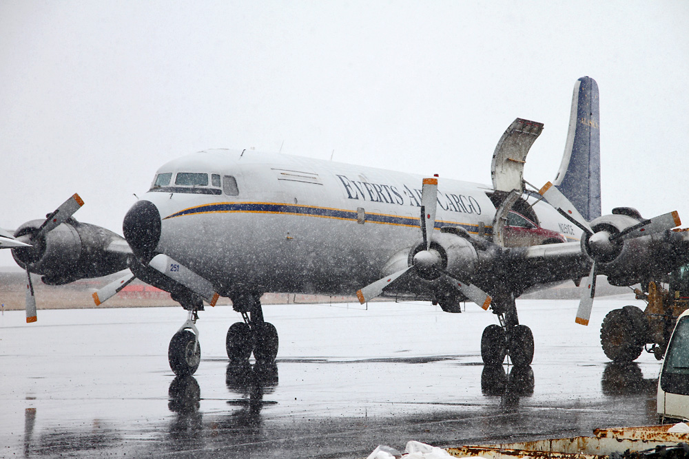
Of course it wasn't the terminal that had caught my interest, but what had just come to a standstill behind it: The DC-6 from Deadhorse! And as one of the baggage handlers informed me, they were just about to unload a car. I definitely needed to see that! And sure enough, here it is!
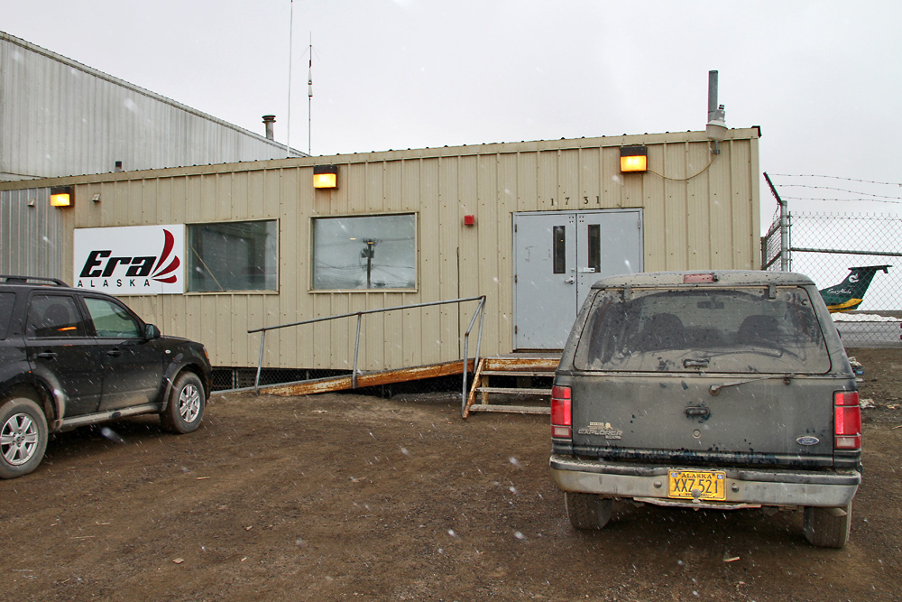
So I wasn't to eager to check out downtown Barrow, and I still had several hours to spend up here before the return flight back down south was to pick me up again. Aware of my beloved Alaska spirit that everything's possible, I headed the bush flights check-in and asked if there were any seats available for one of the Eskimo village runs. Of course there were, and in less than an hour I would take off on a supply run to the communities of Wainwright and Atqasuk!
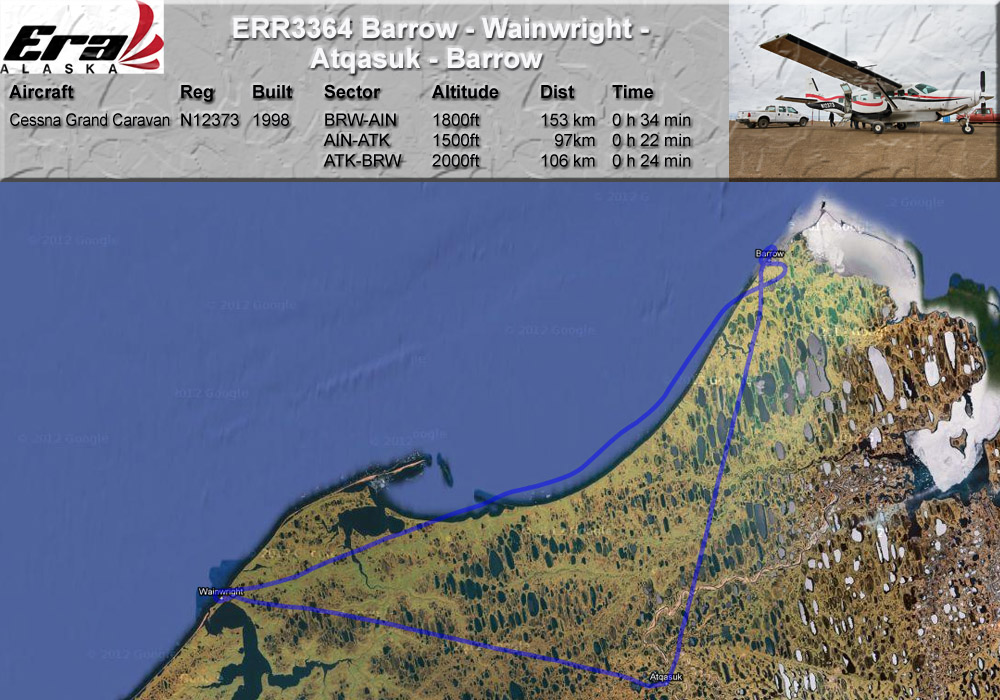
GPS-Track: [url]http://de.wikiloc.com/wikiloc/view.do?id=2506979[/url]
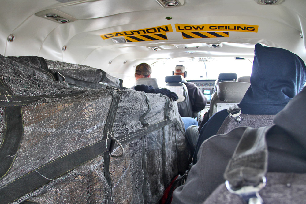
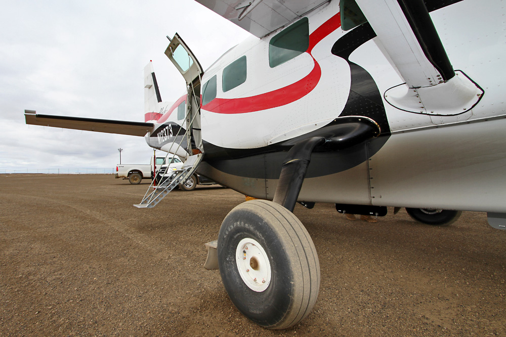
Here I am in one of Era's Grand Caravans, filled to the gills with freight and a few passengers. As you may know, the family-run airline is also the subject of a TV show: Flying Wild Aklaska. [url]http://dsc.discovery.com/videos/flying-wild-alaska-ariel-extras-style-in-alaska.html[/url]
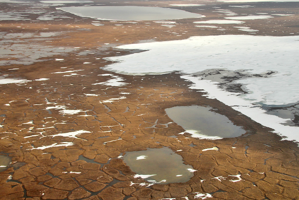
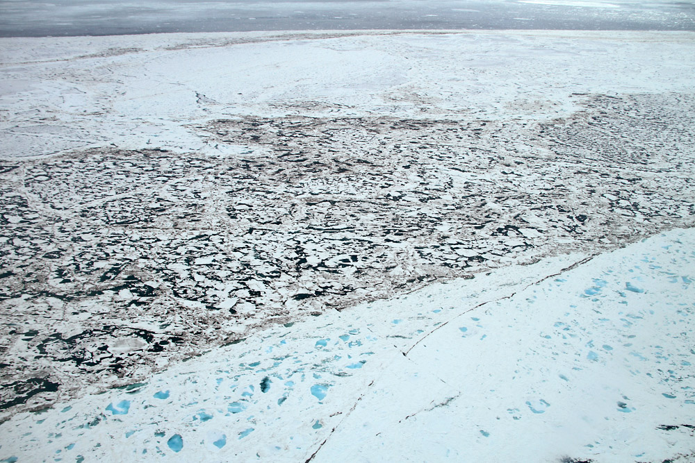
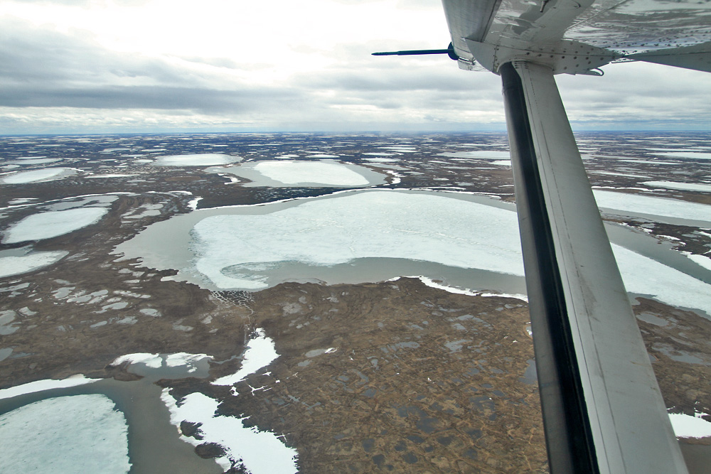
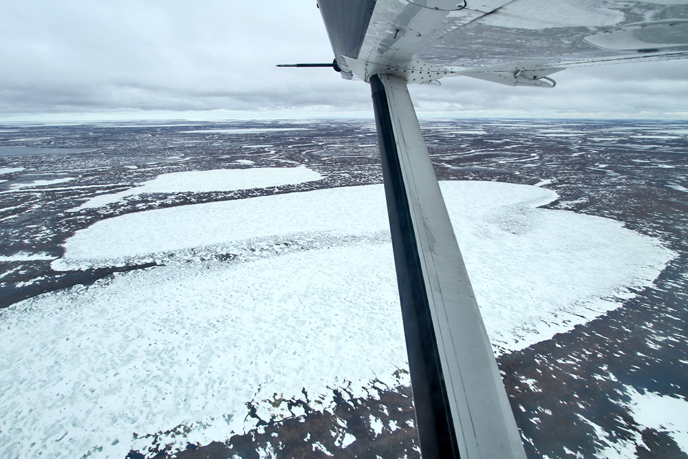
Shortly after takeoff we get a great view of the icy scenery up here: Directly below us the snow covered Tundra, followed by the Arctic Ocean largely covered by ice near the coast, and finally the open waters in the distance.
Whiteout!
With a tight turn our pilot aims for the gravel runway of Wainwright, where we touch down without any problems and finally come to a stop on the tiny apron. Barely had he cut the throttle, when dozens of villagers started approaching out tiny plane on there ATVs, ready to unload their goods.
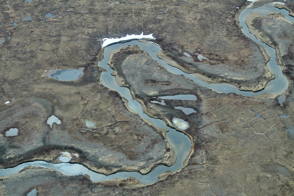
With all this help, it only took a minute or two before we were ready to go again. Looking down on one of a million streams up there after takeoff.
As beautiful and special the unique Tundra landscape up here may be, it does get a trifle repetitive after some time. Therefore I tried to spark up a conversation with the passenger next to me, who turned out to be the flying plumber. Yep, Barrow's plumber gets paid by the community to fly to every surrounding village once a month and take care of the infrastructure there.
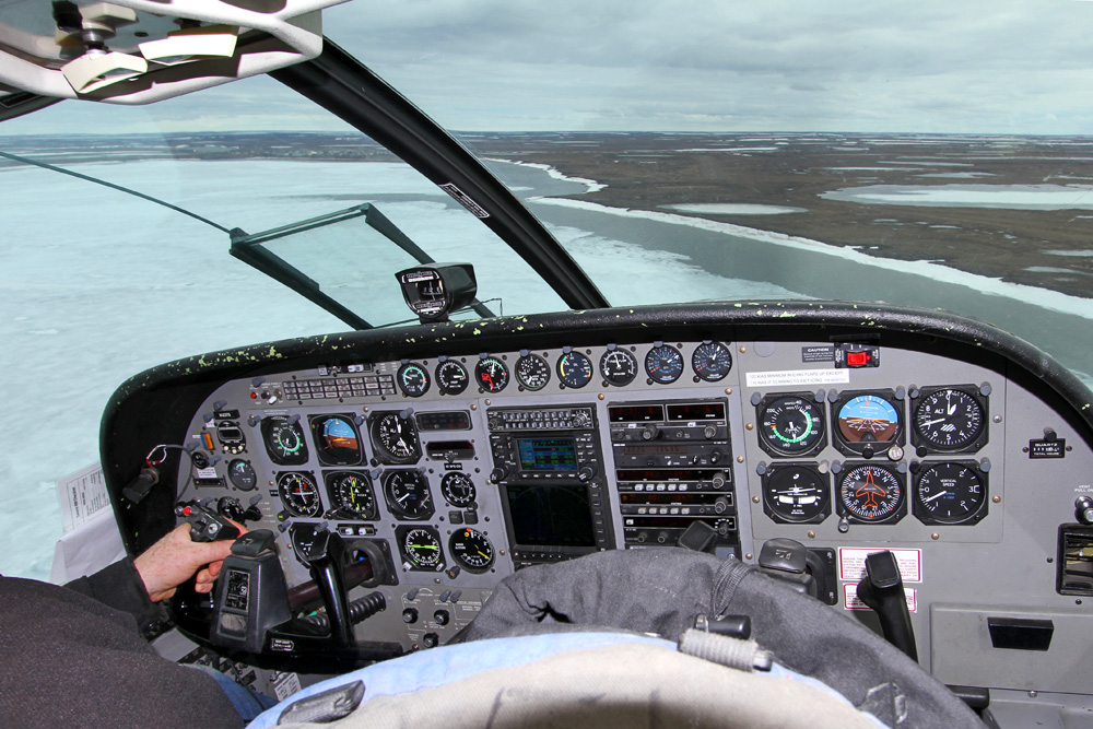
Meanwhile I had gotten myself a seat in the first row, and was therefore able to participate in the search for Atqasuk's tiny dirt runway. Anyone got an idea where it is?
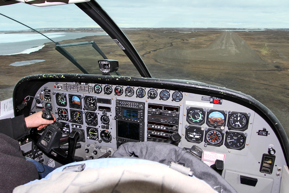
Of course, the pilot knew exactly where it was, and was preparing for a straight-in approach
Same story here: Even though the locals still live mainly from all that nature provides (hunting caribou and whales; fishing), they were eager for all the goodies from civilization we were bringing. Seconds after coming to a stop, we were once again surrounded by a handfull of ATVs and pick-up trucks. While they were busy unloading, I used the time to try out some new photo angles. Getting dirty :)
After visiting both Eskimo villages, we were heading back to Barrow. Here's a video from the takeoff in Atqasuk.
Of course, the scenery was still the same, consisting of a myriad of similar looking lakes. Here's how one of the early aviators of that time, Noel Wien, was coping with the special terrain. He was flying a film crew up to Barrow together with a colleague, but due to bad weather, the two planes were forced to land on one of the lakes, which left one of the aircraft substantially damaged. So finally, there was no choice for Wien but to continue to Barrow alone and get help. The only problem was: When returning, he couldn't find the lake anymore!
[quote]After Noel Wien flew off for help on May 14, 1928, leaving Russel Merrill and the other two men at the frozen lake, he circled until he found a trail that led him to Barrow. He refuelled at Barrow and took off at once, heading southeast. But a strong crosswind was blowing, and drifting snow obscured the route he had flown and so carefully noted a few hours before.[/quote]
From Wien's biography:
I flew up and down over the tundra, five hundred to one thousand feet up. There were just thousands of lakes. The tundra was perfectly flat. The ground and the sky were all the same color. I simply couldn’t find the lake, and I was just sick about it. I flew around for five hours and had to go back to Barrow.
It finally took three weeks of intensive searching to find the lake and the crashed plane again. All three passengers had meanwhile left, trying to get somewhere on foot, and were all found after stumbling through the tundra for days, surviving on a mere cup of Rice a day. If anyone's interested, the stranded pilot's accound of the adventure is available for reading online: [url]http://books.google.ch/books?id=le1znT7v_OEC&lpg=PA134&ots=3vjkTRnHtE&dq=%22noel%20wien%22%22barrow%22&hl=de&pg=PA134#v=onepage&q=%22noel%20wien%22%22barrow%22&f=false[/url]
But back to navigation: It's quite impressive how Wien finally memorized the position of the lake, and shows what a great feat navigation was here before the days of GPS:
Once he had found the Travel Air, Wien knew exactly how to return to it. He marked in his memory the small lake on which the plane sat. It was shaped like a backward letter L, just east of two lakes that formed an exclamation point, just south of a larger lake shaped like a sitting frog, all about seven miles from where Inigok Creek made a pronounced bend eastward.
Back in Wien's times, even the way to Barrow sounded quite adventurous, since setting a direct course wasn't an option due to the unreliable compasses that far north.
The 130-by-130-mile expanse of tundra between the Colville River and Barrow was like a sponge, dotted by at least fifteen thousand lakes of a bewildering sameness in size and shape. On a clear day the flyers could have taken up a course down the Colville to its mouth, then westward along the Arctic coast to Barrow, a distance of about 150 miles. This was a sure navigational plan, because it did not depend upon the unreliable compass needle that in these parts swung thirty degrees away from true north.
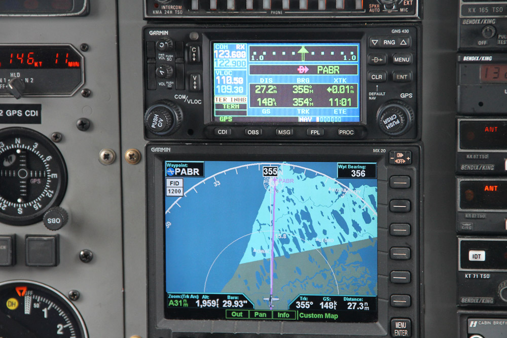
How easy it is today! Just enter "PABR" in your GPS, and there you go!
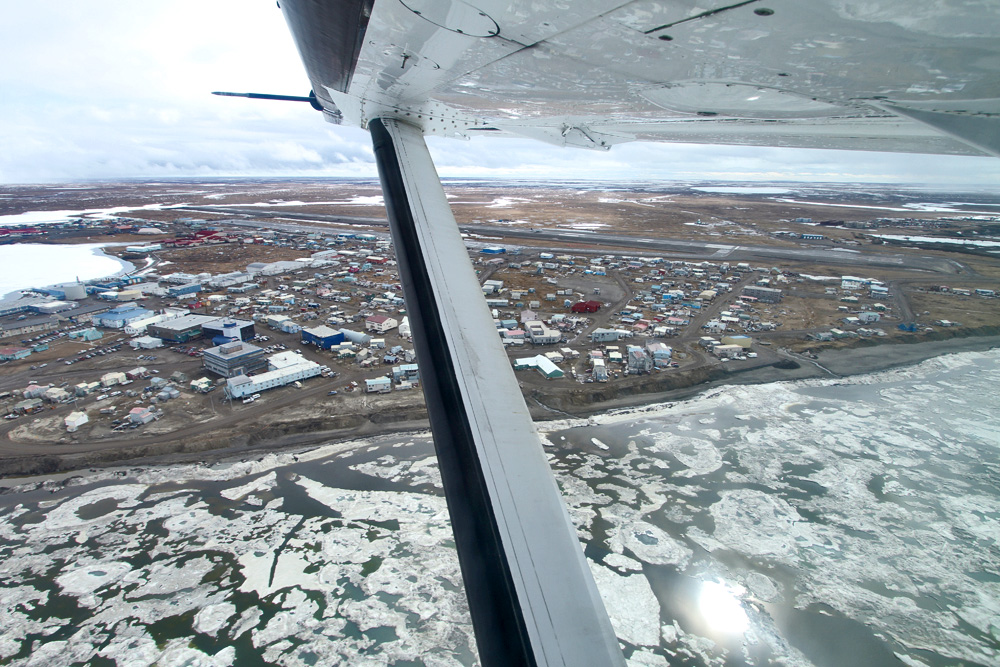
Half an hour later we're back where we started...however, a DC-6 rolling out on the runway required us to perform an additional orbit, allowing me a great view down on downtown Barrow. Nice!
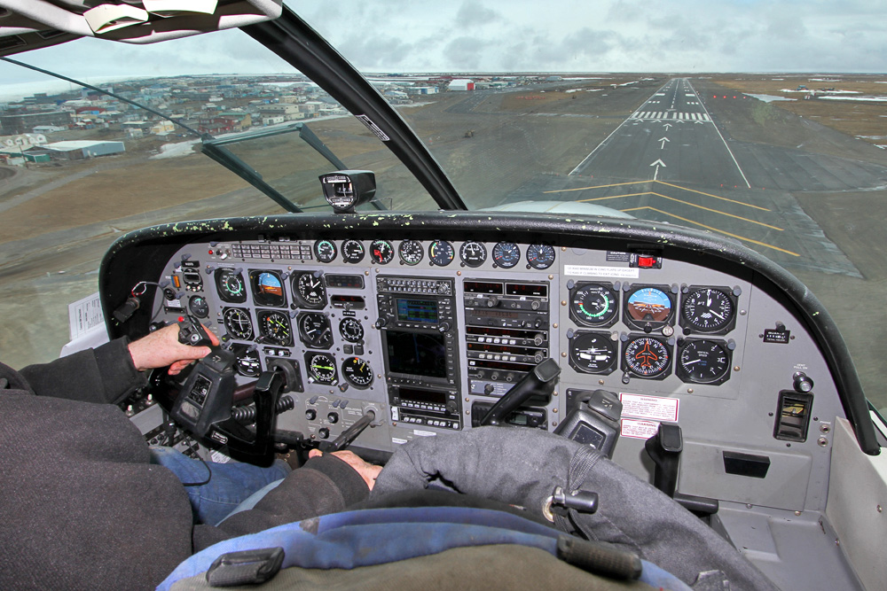
Finally the runway is ours, and we turn onto finals over the partially frozen ocean.
Very short final for the only slab of concrete in town!
Five hours done, just five more to spend up here. What am I gonna do with those? I had a brief look at the area around the airport, but didn't find anything that would've made me stay.
The plumber I'd met on the plane recommended taking a taxi for a short tour around town, as they were so cheap here. However, the philippino driver didn't have a clue what I was talking about. The only thing he *did* now were the fares: "Törti Minu törti dolaaaah, sitti Minu fipeti dolaaaah". Ooookay.
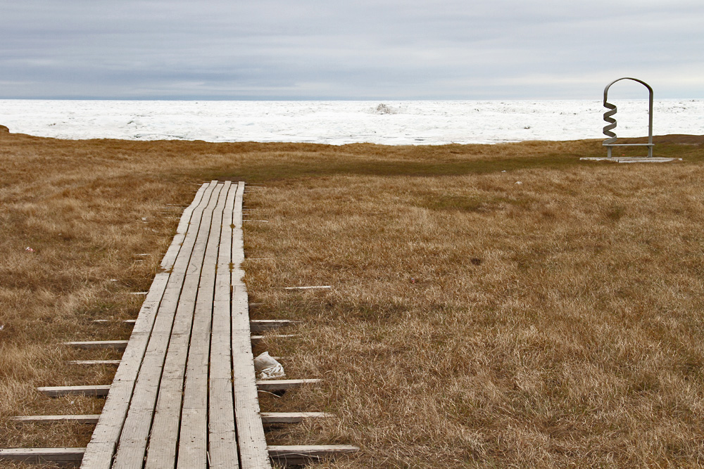
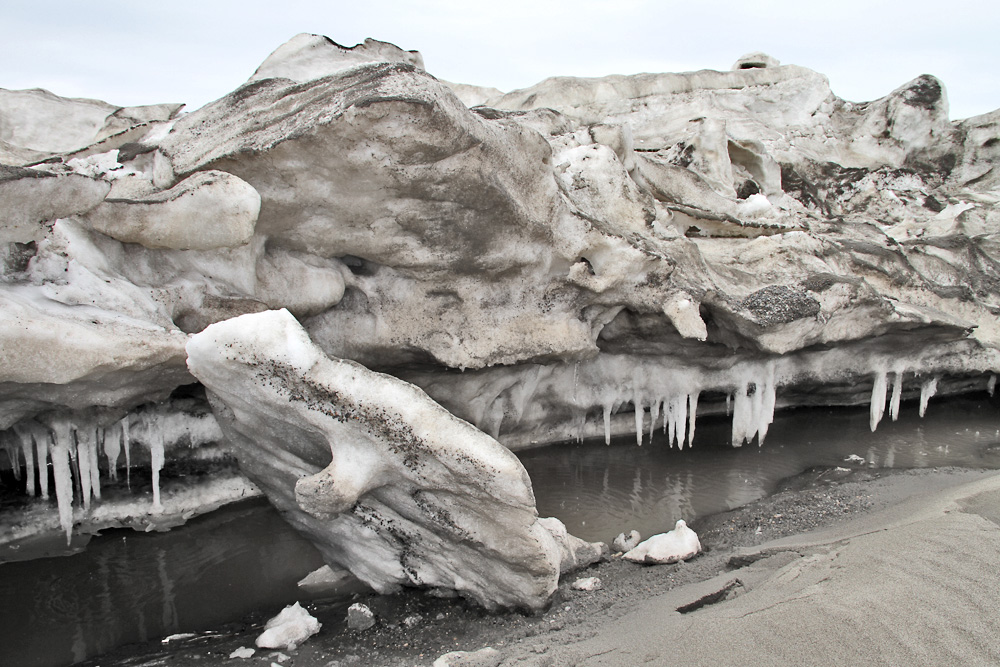
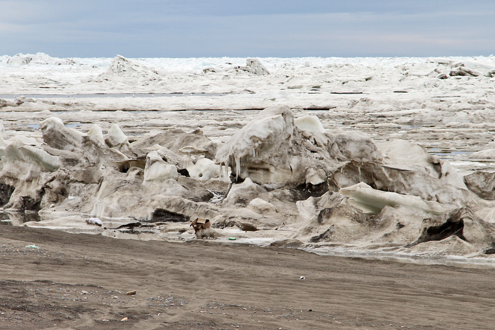
At least I finally got him to take me to the ocean for some more ice shots. Yay!
Getting up close to the frozen pond
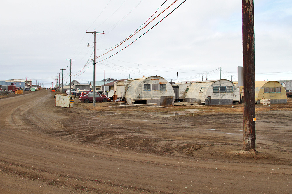
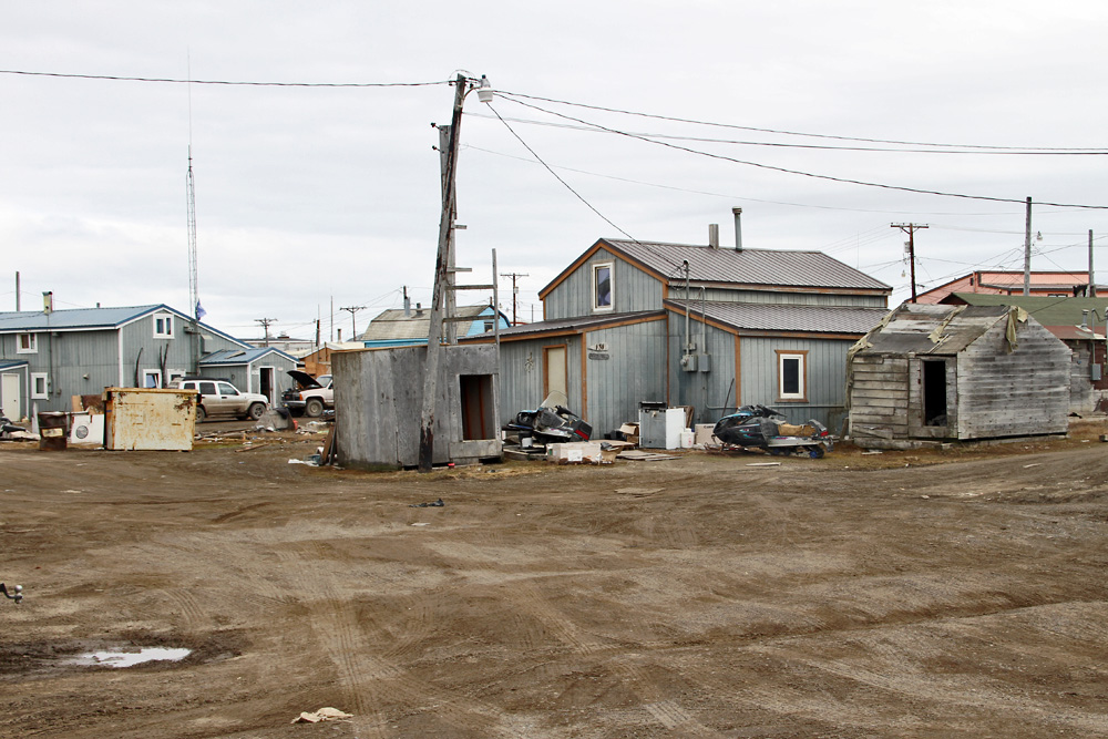
But the longer we drove around town, the less I liked it here. Of course I understand that life up here is hard, and why would you want to keep the town clean if there's hardly any tourist dropping by anyway. But some basic pride for your village, come on! The impression Barrow left was one of a loveless clutter of run down houses, surrounded by heaps of junk, from children's bicycles and skidoos all the way to whole fishing boats just lying around.
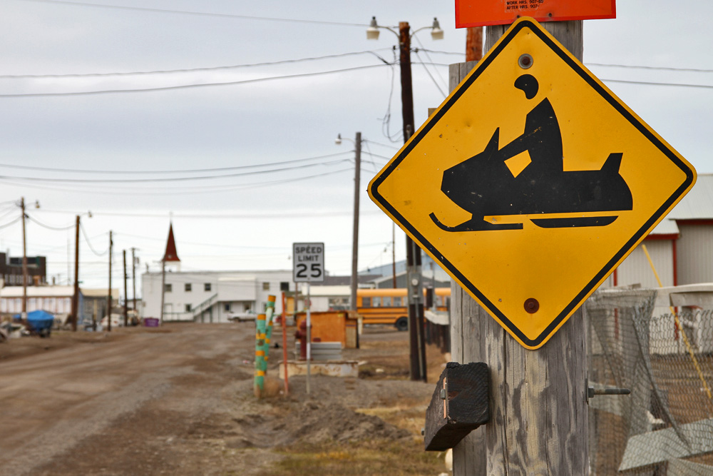
Regardless of that, there need to be rules, too!
Considering all that, the taxi driver's lack of english skills was no problem at all, because there wasn't any sight worth telling me about anyway - apart from a dozen whale jaws maybe, which always caused the driver to yell: "Pictschuuu, Pictschhuuuu" because he found them so impressive. And yeah, I admit, in a way they were...!
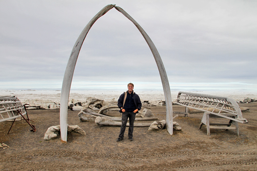
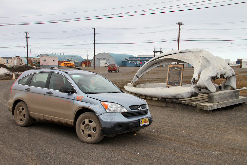
At the next one I took a pictschuuu of him, since the taxi fit so wonderfully in front of this gigantic jaw. The whale, which was hunted in 1987, measured 15.7 meters in length and it took 14 fishing boats to get him to shore.
Since there was nothing more to see in Barror proper, we finally agreed on heading out to Point Barrow, a small spit of land a little outside town, that marks the northernmost point of the USA. After a bumpy ride on a gravel road running along the frozen ocean, we finally reached it, and I could face north and stare at the North Pole - "only" 2090 kilometers away.
With that, I managed to spend another hour, which reduced the rest of my stay to four. Yay. With nothing left to see, I headed back to the terminal, and enjoyed the surprising infrastructure: While there was no cellphone network anywhere in town, there was free WiFi here! I have no idea how the bits and bytes find their way through the tundra, but then again, I didn't really care. And yes, I was a bit relieved, when it was finally time to head back south again.
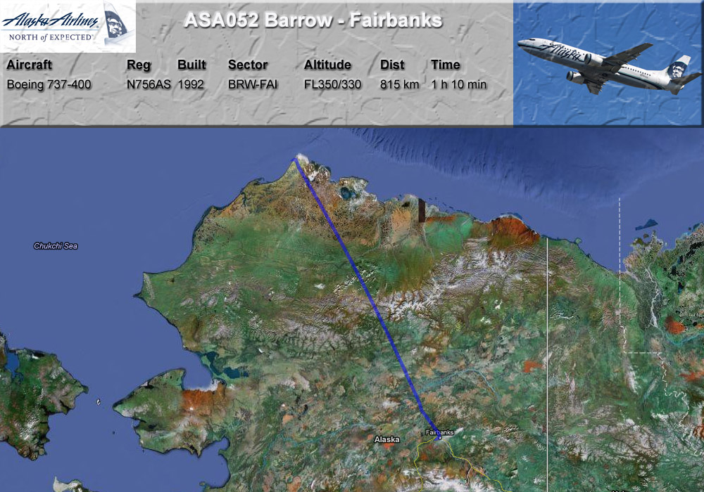
GPS-Track: [url]http://de.wikiloc.com/wikiloc/view.do?id=2505992[/url]
And when, in the approach to Fairbanks, I finally spotted dense green woods in intense shades of green, I was relieved, too. Yes, the scenery up in the arctic, with its myriad of lakes, creeks, and miles of barren tundra is unique and special. But at some point you can't stand seeing even one more of those lakes. But it was a very interesting and life-enhancing daytrip nonetheless!